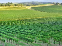
GIS has still yet to be taken up in en masse in agricultural science yet there is massive potential for such areas as agricultural planning, attractive implications for the future of managing our crop production and increasing yields in line with other technology. Agricultural scientists are always looking at ways to best produce our crops,…
Read more
Environmental Planning, Design, and GIS
If there is one area of environmental science in which GIS or Geographic Information Systems/Science is vital, it is Environmental Planning and Design. This is true whether we are looking at an urban or rural landscapes, both of which provide issues of their own with different sets of data and considerations. The role of an…
Read more
Environmental Engineering and GIS
Geographic Information Systems/Science or GIS is becoming, if it is not already, a vital tool for the environmental sciences. It is more than a simple digital evolution from cartography to IT based geographic data and digital mapping offers enormous benefits to research, engineering, project management and resource allocation. Useful in the private and public sector,…
Read more
Groundwater Introduction & Career Avenues
Most of us remember the simplified version of the water cycle we are taught in elementary school in which water from the ocean is heated and evaporated by radiation from the sun, transported over land where is cools and condenses to fall as precipitation before returning to the oceans via runoff. It is a tidy…
Read more
Cultural Resources 101: Part of the Federal Environmental Process
The federal environmental process includes a myriad of individual subjects but there are five big players. These are cultural resources, biology/ecology, hazardous materials, public outreach/involvement and permitting. Cultural resources are relevant for every single federal project that must go through the environmental process. The field encompasses archaeology (prehistoric and historic), historic architecture and Native American…
Read more
Climate Science and GIS
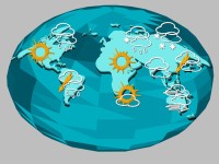
GIS is growing and becoming vital to most sciences; right across the board in the public and private sector, everyone is realizing the benefits that digital mapping can bring to industry, to town planning, resource management and allocation, conservation and infrastructure management. In North America, it has been used to plot pipelines and plan relief…
Read more